GIS systems, drone remote sensing and / or satellites are fundamental tools both for citizens interested in obtaining information on the cultural heritage and for all students and professionals (archaeologists, superintendents, museum administrations …) dealing with the cultural and archaeological heritage management and monitoring Here are some activities supported by GIS and remote sensing solutions:
Process optimization related to the cataloguing and distribution of information involving cultural heritage Analysis to survey and monitor the cultural heritage over the time.
Turn the Information into standard information in order to be shared and used correctly Search and localization of archaeological sites
ARCHEOLOGY
A strong impulse to archaeological research has been provided by satellite remote sensing technology which, through the fine use of sensors with particular spectral bands, allows to highlight lines, broken lines and curves of all the structures otherwise difficult to identify because of the flat perspective, typical of the observation from the ground level. It is thus possible to think of such technologies for the localization of archaeological sites and, moreover, blending these technologies with GIS tools, it is possible to create appropriate Information Systems for archeology.
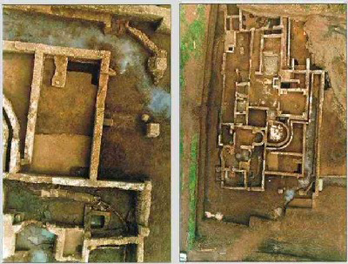
Example of archaelogical sites localizations
ARCHAEOLOGICAL SITES LOCALIZATION
To identify the unknown sites not yet exposed to daylight, this technology can use the information related to the vegetation collocation and the soil moisture, detected by the sensors, luminescence and thermal parameters of the soil itself.
INFORMATION SYSTEMS FOR ARCHEOLOGY
Concerning an archaeological site, the distribution of materials used, its composition and physical characteristics, besides the types of existing deterioration typology, are important elements to include inside an Information System in order to simplify the cataloguing of the materials found and the processing of data, for quantitative and statistical analysis.
In addition to that, a three-dimensional model of the territory extrapolated from the stereoscopical images of the site is a valuable aid in the design of tour itineraries within the site itself.
CULTURAL HERITAGE
Geographical data are essential in the management of architectural and landscape assets and of historical and artistic heritage. The problems related to the enhancement and protection of the Cultural Heritage therefore could find in the GIS technology, as well as in the satellite and drone remote sensing, a valid tool to start a complete conservation process and subsequent intervention and its maintenance, but above all to involve the highest number of users potentially interested in its fruition


