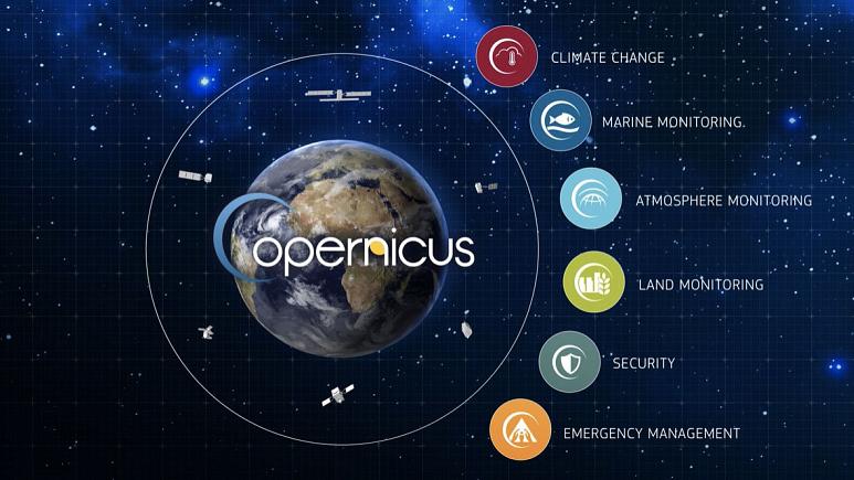
The European Copernicus satellite program, formed by a constellation of 6 satellites, called “Sentinels”, represents the cornerstone of the European Union’s efforts to monitor the Earth and its ecosystems through advanced satellite remote sensing systems.
The Copernicus program provides a huge amount of totally free information about our planet available to citizens, public authorities, scientists and business.
In 2014, with the launch of the first satellite, Sentinel-1A, the Union ushered the putting into orbit of a over a dozen satellites constellation in the upcoming ten years.
Copernicus allows to better understand how Earth is such an integrated system. European citizens, politicians and administrators, researchers, commercial and private users can benefit from the information provided by Copernicus services, in many ways, as well as the global scientific community.
Here are some examples of Copernicus added value in our daily life:
AGRICULTURE Periodical evaluation of cultivated areas; monitoring of crops development on a regional and global scale; food safety assessment; crop estimation; support for sustainable agricultural practices (e.g. estimating water needs)
CIVIL PROTECTION AND HUMANITARIAN AID Through the European Emergency Response Coordination Center (ERCC12): forecast and response organization to disasters and humanitarian crisis, accurate geographic information for the population rescue, logistics, fresh water supplying infrastructure, demographics, health and environmental facilities to areas affected by natural or man-made disasters
CLIMATE CHANGE Strong scientific evidence for the geophysical variables characterizing climate change; climate indicators (e.g. temperature increasing, sea level rising, ice melting, oceans warming ; climate index (based, for example, on temperature measurement, rainfall level, drought events);
COOPERATION AND DEVELOPMENT Applications to supervise agriculture and food assurance, deforestation, desertification and biodiversity in developing countries, in collaboration with partner countries and international organizations (such as the African Union, and the United Nations institutions);
ENERGY Valuable support to select and manage renewable energy production sites through information supply with specific characteristics, including water reserves presence, precipitation and snow accumulation levels during the winter; critical infrastructure control, such as nuclear power plants, or essential infrastructure protection such as power plants or gas / oil pipelines; energy efficiency evaluation in industrial plants and buildings
ENVIRONMENT Atmospheric composition, snow, ice and biodiversity monitoring; evaluation of water cycle parameters, such as soil moisture or water bodies analysis; forests and coastal areas monitoring; soil periodic supervision and waterproof surfaces evaluation; forestal heritage damage assessment and desertification monitoring; European oceans and seas, marine environment and coastal supervision, marine waters quality; observations such as the ocean color and the sea level;
INSURANCE Applications to support geological risk modeling, danger and damage assessment, claims management;
HEALTH Air quality check in Europe and global atmospheric composition; possible outbreaks of epidemics or disease mapping; public health emergency planning
BLUE ECONOMY Marine environment supervision in order to improve its knowledge and to encourage the maritime economy sustainable development in various areas including offshore hydrocarbon activities or coastal and marine tourism;
TOURISM Coastal areas supervision; supply of critical issues indicators and evaluation and planning index of seasonal tourism activities, such as the snow surface, the bathing water quality at European level; the natural and cultural heritage protection contribution;
AIR, LAND, MARITIME TRANSPORT Shipping routes or possible oil spills monitoring, maritime traffic control for safety reasons;aviation safety and air traffic support in exceptional circumstances; geological risk analysis and environmental risk assessment for land transport in critical areas
SECURITY European Union external actions support, including peacekeeping operations, European territory and sea borders supervision and surveillance, maritime general surveillance to support different communities;
URBAN AND REGIONAL PLANNING Land use and land use changements check on a regional or urban level ; detailed high resolution mapping of the major European cities, in support of urban planning ensuring balanced and sustainable development.
The various Sentinel missions will pursue the following targets:
- Sentinel-1 will provide radar data to support land area monitoring services. The first Sentinel-1a satellite was launched on 3 April 2014 with a Soyuz rocket from French Guyana.
- Sentinel-2 will provide high resolution optical images for terrestrial services (eg vegetation, soil, inland waters and coastal areas monitoring). Sentinel-2 was launched on 25 June 2015
- Sentinel-3 will provide services for global land and ocean areas monitoring. It has been launched on 16-2-2016.
- Sentinel-4 will provide atmospheric composition data.
- Sentinel-5 will support Sentinel-4 in providing atmospheric composition data.
- Sentinel-6 will contribute to precision elevation detection missions.
Reference link: www.copernicus.eu


