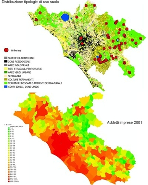
GEOMARKETING means the use of geography to make the decisions and activities concerning Communication, Sale, Distribution and clients Service more efficient and incisive.
Thanks to Geomarketing, companies enhance the spatial dimension of numerous data, continuously produced by various internal and external information sources.
We can summarize the spatial dimension of a data with the simple word WHERE. Where is a relevant information in the marketing process because geography becomes a unit or even the privileged unit of sales data analysis. From this perspective, the information sequence becomes: WHO – DOES WHAT – WHERE. The first two data (who, does what) thus joined the territory in which they are produced and transformed into relevant information to make a decision.
“Where” can take on many different meanings, according to the decision makers:
Where do our customers reside?
Where do they work?
Where do they go shopping?
Where do they go in their free time?
Where are our competitors located?
How are our sellers visits configured?
What are the best places to open new stores?
Where are bank branches, public offices, places of attraction and entertainment located? and so on.
Map example
STATISTICS
Geostatistics is the branch of statistics dealing with geographical data analysis. Its classical application field is Earth Sciences, especially in Geography,
Geology, Environmental Geology, Ecology, Meteorology, Agronomy. It also finds application in other fields such as economic analysis, epidemiological studies, etc.
Geostatistics deals with the spatial data correlation evaluation, verifying whether nearby points observations actually show a higher correlation than distant points observations. So the goal is to evaluate how this autocorrelation varies according to the separation vector considered (therefore distance and time). The study of space continuity and the necessary data exploratory study allow us to observe with outstanding detail the analyzed phenomena, understanding the statistical-spatial data structure in terms of the physical-chemical processes involved.
Also, mapping numbers and tables is easier when associated with maps and geographic details, that is to say, capable of making intelligible data in and of itself already complex.


